
Aerial Lidar
The Aerial LIDAR system is used to create 3D maps from the air. It is being developed for jungle surveys of Maya temples in Guatemala.
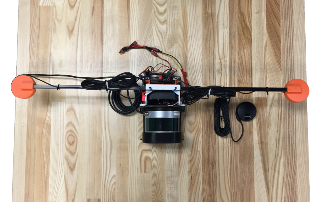
The LIDAR system currently uses a Velodyne Puck LIDAR and a GPS unit.
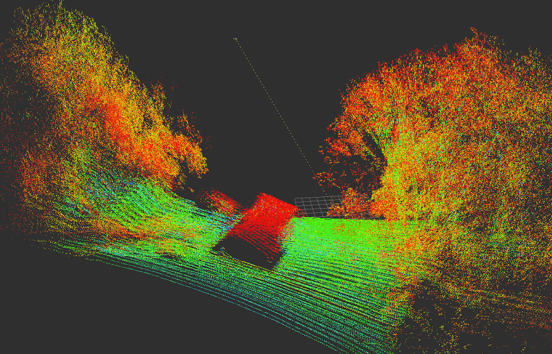
The individual LIDAR scans are stitched together into a point cloud showing terrain, elevation data, and other environmental characteristics.
Please contact our staff (e4e@ucsd.edu) for more information.