Floods of Lubra
As weather patterns change across the world, there are communities impacted by climate change that are left unnoticed. In the Himalayan mountain range, communities have suffered, experiencing an increase in flash flooding and droughts. For Lubra Village in Lower Mustang, Nepal, the community faces threats of flash flooding.

In the Annapurna Conservation Area, Lubra Village is under threat as Himalayan climate changes. (Photo by Ronan Wallace, 2022)
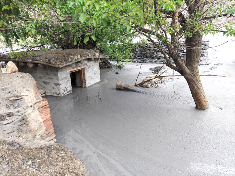
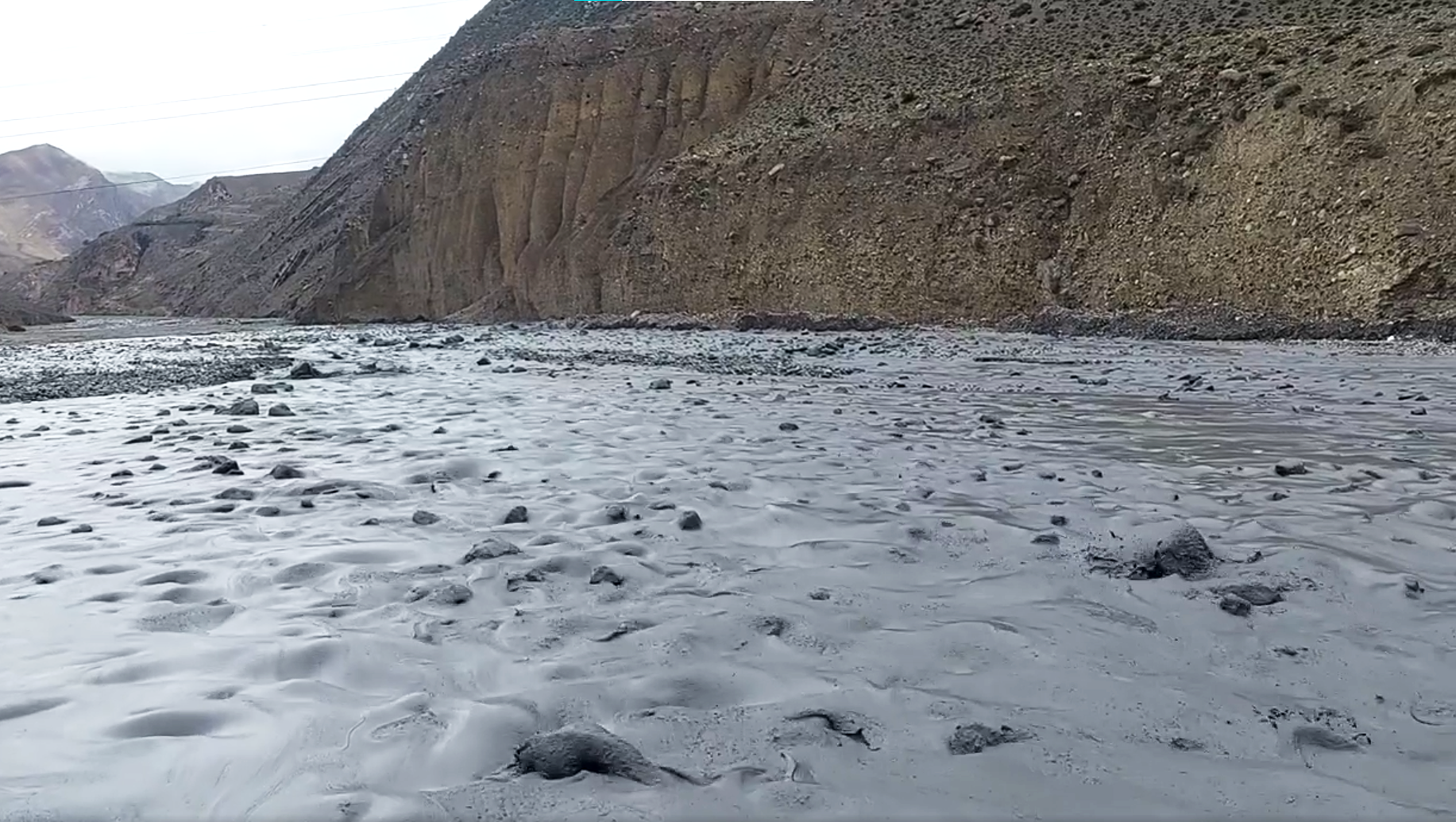
Over the last ten years, the amount of flash flooding has increased, occurring more than once each monsoon season. After every flood, concrete-like sediment is left behind, hardening across the riverbed and increasing the elevation. As the riverbed elevation increases, this sediment encroaches on Lubra Village’s agricultural fields and homes, making them more vulnerable to flood damages. In the last monsoon season alone, the village has seen the flood swallowing several fields, as well as damaging two homes.

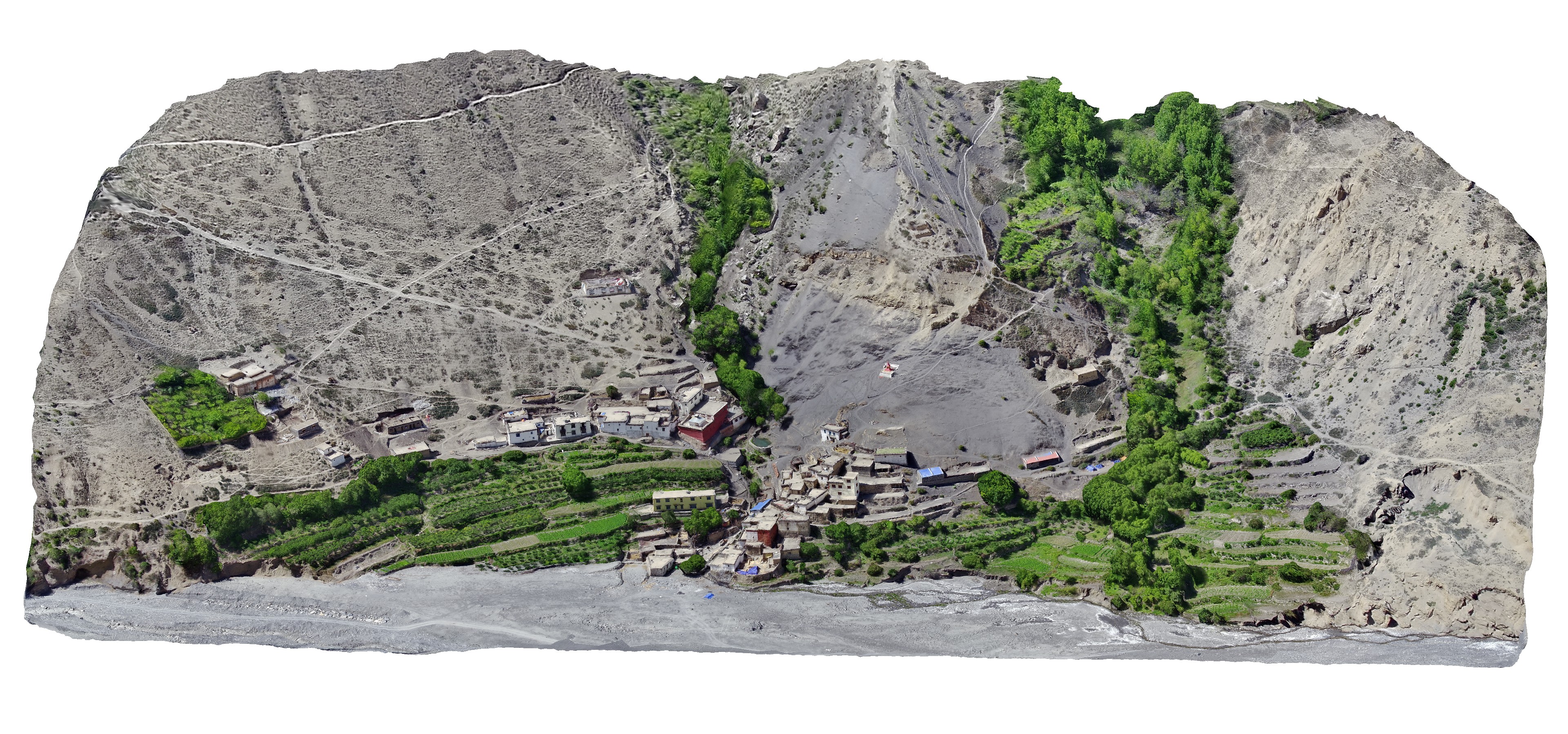
Lubra Village situated on the river edge in Lubra Valley. (Photo by Ronan Wallace, 2022)


In the Annapurna Conservation Area, Lubra Village is under threat as Himalayan climate changes. (Photo by Ronan Wallace, 2022)

Land changes recorded during the 1950s (yellow line), 2002 (blue line), 2018 (red line), and 2022 (purple line). (Photo by Ronan Wallace and Dane Carlson, 2022)

Two 3D models of Lubra Village showing how the riverbed has risen between 2016 and 2022. (Figure by Ronan Wallace, 2022)
In order to keep the community safe, the community has been in discussion of relocating the village entirely to a new and safer location. However, relocating the village is a challenging task, where complex nuances exist in both aspects of civil engineering and communal opinions.
To investigate this issue further, we look to conversing with the community to understand their needs and perspective. From them, we will be able to develop a plan that amplifies the voices of Lubra Village. Additionally, we use remote sensing and 3D digital modeling to visualize the village and the new proposed location sites. These models will then be used by the architecture planning and development team to better understand the terrain and layout of the village. From these models, the team will be able to make more informed decisions on how to plan and develop the new village.
Village Relocation Models
Home Construction Model
To read more about relocation and visualizing flood damages, feel free to take a look at one of our reports below:
Current Reserach
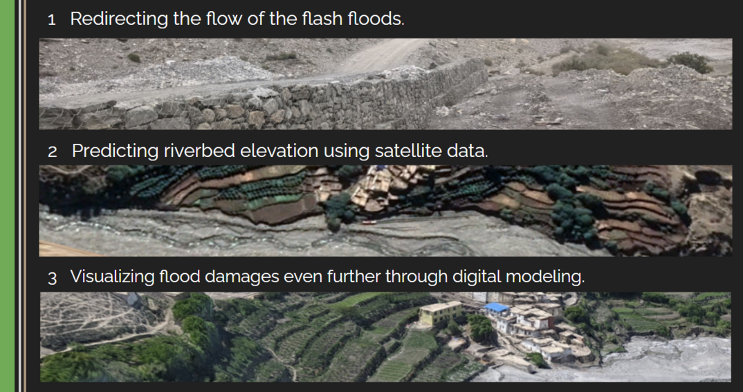
Moving forward, there are three subproblems under flooding that are worth exploring:

Redirecting Flash Floods
The community has been experimenting with digging a trench to redirect the flow of floods. However, this solution can be very expensive. To fully understand the costs to fully implement this solution, we must understand the volume of the flood that flows through the valley. Having this volume estimation, we can determine the required dimensions of this trench for this to be a successful solution. This will help in developing the required budget, along with determining how feasible this solution is.
Predicting Riverbed Elevation
To understand flooding further, we can look at how the elevation of the riverbed has changed over the last 20 years. With this information, we can see a trend in how the elevation is changing, and use this information to predict where the elevation will be after the next monsoon. This will give insight on which homes will be affected next by the floods, and how much agricultural land will be left for farming. One issue with this, however, is a lack of data. There is currently no formal dataset that we know of that provides elevation changes of our area of interest. To solve this, we can look to satellite data over the last 20 years to compile these changes. This can be done by taking satellite imagery and using it to create a digital elevation model (DEM) of the riverbed every year. From this, we can analyze if there is a trend in increasing elevation, how it correlates to changing weather patterns, and what that looks like for the future.
Visualizing Flood Damages
When it comes to visualizing flood damages, there is a lack of data and lack of visuals in representing the floods that occur in Lubra. Because of this, not many people know about the flooding, and those that do, react briefly then forget about the issue after the monsoon. Furthermore, Mustang locals and trekkers are skeptical of the Panda Khola River being dangerous in terms of flooding. These conclusions are made, however, when the river is visually small and tame. These people don’t actually see how catastrophic it can be. Additionally, other villages are skeptical because they experience climate change in terms of drought, not flooding, so they don’t believe that there is damage occurring from excess water.
With that being said, it is imperative to develop a way to effectively visualize flooding in a way that conveys the damages it is causing. After acquiring the riverbed elevation prediction as mentioned above, we can get a general idea of where the elevation will be after the next monsoon season and beyond. We can then visualize this using a 3D model of the village to demonstrate where the new elevation will be, and show how imperative it is to act now. These visualizations can be further used in proposal development for acquiring funding to relocate the village and redirect the floods.


3D model of Lubra river (top) and Lubra village (bottom). (Models by Ronan Wallace, 2022)
If you’d like to learn more about the project, or wish to get involved, please contact project lead Ronan Wallace at rwallace@macalester.edu or e4e@ucsd.edu.
In the News
Mustang Forced to Adapt to Climate Crisis | Nepali Times
Conferences and Presentations:
- Bonn Sustainable AI Conference — “Sustainable AI Across Borders” at the University of Bonn, Germany (May 2023)
- Journal of Critical Global Issues — Virtual Roundtable Discussion at School For International Training, USA (May 2023)
- Human Development Conference — “Solidarity in Development: Empowering Agents of Change” at University of Notre Dame, USA (Feb. 2023)
- Midstates Consortium for Math and Science — “Undergraduate Research Symposium in the Physical Sciences, Math, and Computer Science” at Washington University in St. Louis, USA (Nov. 2022)
- Research Showcase at Macalester College, USA (Sep. 2022)
- SIT Research Symposium in Kathmandu, Nepal (May 2022)
